Wednesday, Nov. 19 | Music Hall Lounge, Portsmouth, NH
What's Down There?
Mapping the Seafloor
.jpg)
Researchers from UNH’s world-leading Center for Coastal and Ocean Mapping share the latest findings and insights from the leading edge of ocean mapping and hydrography. Learn how UNH is helping find World War II shipwrecks in the South Pacific, mapping areas of the Arctic for the first time ever, and advancing the use of robotic vessels in the quest to create a complete map of the world’s oceans.
Doors open at 5 p.m.; talks begin at 5:30 p.m. Drinks and light snacks will be available for purchase.
Tickets: $10, $5 students
SOLD OUT!

Speakers


Larry Mayer is a professor and the director of the Center for Coastal and Ocean Mapping at UNH. He graduated magna cum laude with an Honors degree in Geology from the University of Rhode Island in 1973 and received a Ph.D. from the Scripps Institution of Oceanography in Marine Geophysics in 1979. After being selected as an astronaut candidate finalist for NASA's first class of mission specialists, Larry went on to a postdoc at the School of Oceanography at the University of Rhode Island. In 1982, he became an assistant professor in the department of oceanography at Dalhousie University and in 1991 moved to the University of New Brunswick. In 2000 Larry became the founding director of the Center for Coastal and Ocean Mapping at the University of New Hampshire and the co-director of the NOAA/UNH Joint Hydrographic Center.
Larry has participated in more than 90 cruises (over 70 months at sea!) during the last 35 years and has been chief or co-chief scientist of numerous expeditions, including nine mapping expeditions in the ice-covered regions of the high Arctic. He has served on, or chaired, far too many international panels and committees and has the requisite large number of publications on a variety of topics in marine geology and geophysics. He is the recipient of the Keen Medal for Marine Geology and an Honorary Doctorate from the University of Stockholm. He was a member of the President’s Panel on Ocean Exploration, National Science Foundation’s Advisory Committee for the Geosciences, and chaired a National Academy of Science Committee on national needs for coastal mapping and charting as well as the National Academies report on the impact of the Deepwater Horizon Spill on ecosystem services. He is currently the Chair of the National Academies of Science’s Oceans Studies Board, Chair of the MARUM Science Advisory Board, and is a member of the State Department’s Extended Continental Shelf Task Force and the Navy’s SCICEX Advisory Committee. In 2016, Larry was appointed by President Obama to the Arctic Research Commission and in 2017 he was elected to the Hydrographic Society of America Hall of Fame. In 2018, he was elected as a member of the National Academy of Engineering, and, in 2019, was elected as a foreign member in the Royal Swedish Academy of Sciences. In 2020, Larry was selected as the first recipient of the Walter Munk Medal from the The Oceanography Society and named a Fellow of the American Geophysical Union. In 2021 he was elected to the Norwegian Scientific Academy for Polar Research and in 2022, he received the Sam Masry Prize from the Canadian Hydrographic Association for outstanding contributions to the hydrographic profession and its related disciplines.
Larry's current research deals with increasing the efficiency and effectiveness of seafloor mapping and remote characterization of the seafloor (including through the use of autonomous vehicles) as well as advanced applications of 3-D visualization to ocean mapping problems and applications of mapping to Law of the Sea issues, particularly in the Arctic.
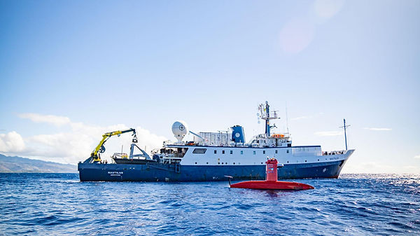
Val Schmidt leads the Center for Coastal and Ocean Mapping’s marine robotics program, where he and a team of engineers and graduate students solve problems to “make autonomy practical.” Val holds a bachelor’s degree in physics with honors from the University of the South, (Sewanee, TN, 1994), and a M.S. in ocean engineering, with an emphasis in ocean mapping, from UNH’ s Category A Hydrographic program. From 1994-2000, Val served in the U.S. Navy as an Officer in the U.S. submarine fleet, as Radiological Controls Officer and later Sonar Officer aboard the USS Hawkbill. Since 2008, he and his team at CCOM have deployed un-crewed vehicles, from shore and from ships at sea, for marine science and seafloor mapping missions around the world, including recent missions with autonomous surface vehicles (ASVs) from NOAA Ship Fairweather (2018), Exploration Vessel Nautilus (2017, 2018, 2021, 2022 x3), NOAA Ship Shearwater (2017), and NOAA Ship Thomas Jefferson (2019 and 2022). Val has also deployed ASVs from shore in NOAA Thunder Bay National Marine Sanctuary (2019 and 2021), and countless other day deployments from our own vessel and from shore off the New Hampshire coast.
Gabrielle Trudeau is a Ph.D. student in integrated applied mathematics at UNH. Fascinated by the intersection of technology and the natural world, her research applies machine learning and remote sensing to study coral reef environments. By developing new metrics and reef monitoring methodologies, Gabrielle aims to leverage satellite data and the power of mathematical models to solve real-world problems. She conducts her research with the Center for Coastal and Ocean Mapping where she is advised by Dr. Kim Lowell and Dr. Mark Lyon. Gabrielle holds a B.S. in computer science and mathematics from Westfield State University. Outside CCOM, she is a devoted plant mother and can often be found sipping lattes at her favorite local coffee spots.